North West Resilience and Adaptive Capacity

Read the full North West Regional Drought Risk, Resilience and Adaptive Capacity Report
Read the North West Report Executive Summary
As part of the project, we have published three regional reports. These provide a starting point for understanding drought impacts and risks in our regions. We would appriciate your feedback and suggestions, as we aim to ground-truth these reports over the course of the project.
In the north west, in summary, droughts occurred during 2006, 2008, 2014 and 2015. These events offer insights on the impacts to agriculture and the natural environment, and the potential resilience of communities to future droughts.
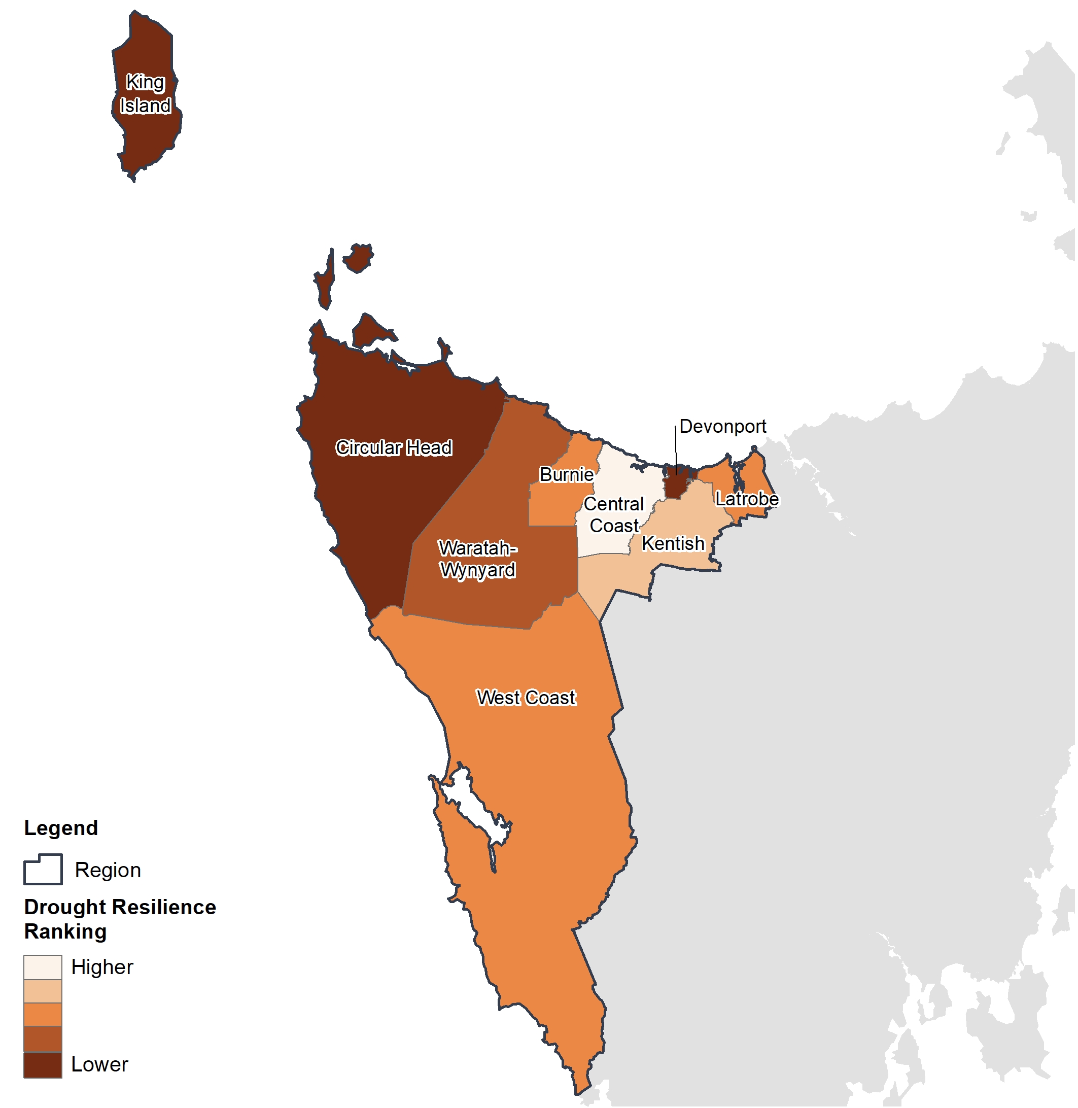
Drought resilience was determined by analysing the potential drought impact (risk) and adaptive capacity of each of the nine LGAs in the North West region.
This map shows the Central Coast has higher adaptive capacity potential to drought, whereas West Coast displays lower adaptive capacity to drought. The potential drought impact (risk) showed King Island with higher risk rating, while Burnie was lower based on the Australian Bureau of Agricultural and Resource Economics and Sciences (ABARES) Community Vulnerability & Resilience to Drought Index (CVRDI).


